Goessnitzkees (Carinthia, Austria):
|
Goessnitzkees
(12°45' E, 46°58' N) is a small debris-covered cirque
glacier located in the Schober group of the Hohe Tauern
range, Austrian Alps. The glacier covered an area of some
0.75 km² in 1997. In 1982 Goessnitzkees was included into
the network of annual glacier measurements of the Austrian
Alpine Club (ÖAV). Since 1982 until now all annual
measurements (mid-September) on Goessnitzkees have been
carried out by members of the Institute of Geography and
Regional Science of the University of Graz (UNI Graz).
From 1996 to 1998 a glacier study under the leadership of
G.K. Lieb (Institute of Geography and Regional Science,
UNI Graz) was carried out in order to reconstruct the
glacier history of Goessnitzkees from 1850 (maximum extent
of glaciation) until 1997. In 1996 the former Institute of
Geodesy of the Graz University of Technology selected
Goessnitzkees as a test site for high-mountain studies. A
three-dimensional geodetic network was installed for this
purpose, comprising also some reference points of the
previously described annual measurements for ÖAV.
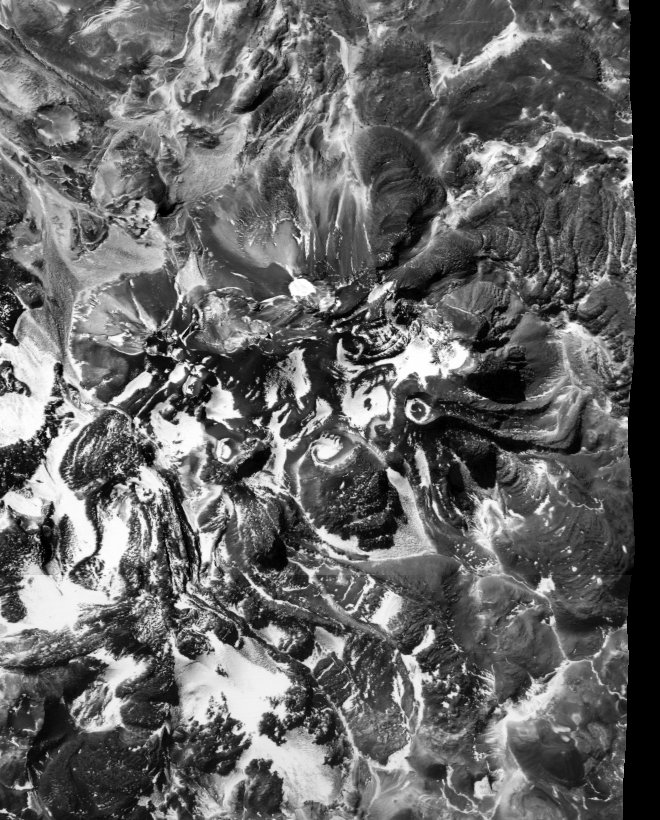
|
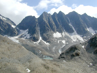
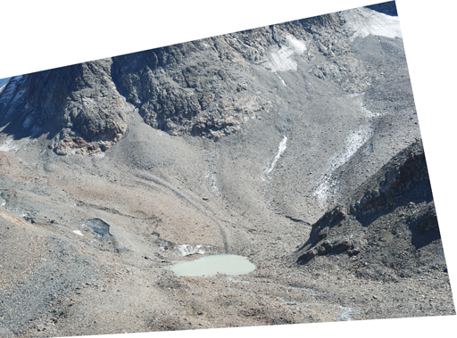
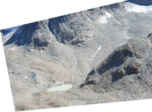
Goessnitzkees. Photograph taken in September 2004. The viewing
direction is from the photogrammetric baseline in a south-easterly
direction.
References (selected):
- Lieb, G.K. (1982): Der Kärntner Teil
der Schobergruppe und seine Gletscher. Kärntner
Naturschutzblätter, 21. Jg., S. 129-142. [ PDF
]
- Lieb, G.K. und Kaufmann, V. (1985): Vier Jahre Gletschermessung in der
Schobergruppe. Kärntner Naturschutzblätter, 24.
Jg., S. 123-135. [ Paper ]
- Lieb, G.K. (1987): Die Gletscher und
Blockgletscher im Kärntner Teil der Schobergruppe und ihre
Entwicklung seit dem Spätglazial.
Unveröffentlichte Dissertation, Universität Graz, 286 S. [ PDF
]
- Lieb, G.K. (1987): Zur
spätglazialen Gletscher- und Blockgletschergeschichte im
Vergleich zwischen den Hohen und Niederen Tauern.
Mitteilungen der Österreichischen Geographischen
Gesellschaft, 129. Jg., 5-27. [ PDF
]
- Buchenauer, H.W. (1990): Gletscher-
und Blockgletschergeschichte der westlichen Schobergruppe
(Osttirol). Marburger Geographische Schriften
117, in German, 276 p.
- Lieb, G.K. und Sulzer, W. (1993): Gletschermessungen
in der Schobergruppe 1982-1992. GeoGraz, Heft 12,
Institut für Geographie, Universität Graz, 4-6. [ PDF
]
- Lieb, G.K. (1996): Permafrost und
Blockgletscher in den östlichen österreichischen Alpen.
Arbeiten aus dem Institut für Geographie der
Karl-Franzens-Universität Graz 33, in German, 9-125.
- Kaufmann, V. (1998): Gößnitz- und
Hornkees, Schobergruppe, Luftbildkarte 1:10 000. Befliegung 1.9.1997, Blattschnitt 48 cm x 40 cm, ehem. Institut für
Angewandte Geodäsie, Abteilung für Photogrammetrie und
Fernerkundung, TU Graz, 48 cm x 40 cm. [ Karte/Map
]
- Krobath, M. (1999): Naturräumliche
Ausstattung des Talschlusses der Gössnitz (Schobergruppe). Unpublished
diploma thesis, University of Graz, in German, 62 p.
- Kaufmann, V., Krobath, M., Lieb, G.K. und Sulzer, W. (1999):
Gössnitzkees- und Hornkees - die
Entwicklung zweier Kargletscher der Schobergruppe
(Nationalpark Hohe Tauern, Kärnten) seit dem Hochstand 1850.
Endbericht zum Forschungsprojekt (Projektleiter: G.K. Lieb)
des Kärntner Nationalparkfonds, Institut für Geographie,
Universität Graz, 76 Seiten, mit zahlreichen Farbabbildungen
und einer Luftbildkarte 1:10.000 „Gößnitz- und Hornkees,
Schobergruppe". [ Abstract
]
- Kaufmann, V., Plösch, R., Javurek, P. and Lieb, G.K (1999):
Investigations on the retreat of two
small cirque glaciers (Goessnitzkees and Hornkees) in the
Austrian Alps, Europe. Video-film produced at Studio
AV-Media CIS, Graz University of Technology, 12 min 30 sec,
including computer animations of the glacier retreat. [ YouTube
]
- Lieb, G.K. (2000): Die
Flächenänderung von Gößnitz- und Hornkees (Schobergruppe,
Hohe Tauern) von 1850 bis 1997. In: Festschrift für Heinz Slupetzky zum 60.
Geburtstag, Salzburger Geographische Arbeiten, 36, 83-96.
[ PDF
]
- Kaufmann, V., Plösch, R. (2000): Reconstruction and visualization of the
retreat of two small cirque glaciers in the Austrian Alps
since 1850 - From static maps towards dynamic computer
animation. In:
Buchroithner, M. (Ed.), High Mountain Cartography.
Proceedings of the Second International Symposium of the
Commission on Mountain Cartography of the International
Cartographic Association, Alpine Centre Rudolfshütte,
Salzburg, Austria, 29 March – 2 April 2000, Kartographische
Bausteine, Band 18, Dresden University of Technology, pp.
239-253. [ Abstract] [ Paper
text only] [ Video ] [ YouTube
]
- Kaufmann, V. and Ploesch, R. (2000):
Mapping and visualization of the
retreat of two cirque glaciers in the Austrian Hohe Tauern
National Park. International
Archives of Photogrammetry and Remote Sensing, Vol. XXXIII,
Part B4, Amsterdam 2000, pp. 446-453. [ Abstract ] [ Paper ] [ Video ] [ YouTube
]
- Kaufmann, V. (2001): Quantitative
Erfassung der Morphodynamik von Gletschern und
Blockgletschern - Projekte und methodische Untersuchungen im
Nationalpark Hohe Tauern.
Proceedings "Symposion zur Forschung im Nationalpark Hohe
Tauern", 15-17 November 2001, Burg Kaprun, Salzburg,
Austria, p. 217-223. [ Abstract ] [ Paper ]
- Kaufmann, V. and Lieb, G.K. (2002): Investigations
on
the
retreat
of
two small cirque glaciers (Goessnitzkees and Hornkees) in
the Austrian Alps, Europe. High-Mountain Remote
Sensing Cartography 1998 - Proceedings of the 5th
International Symposium on the Use of Remote Sensing Data in
Mountain Cartography, Karlstad University Studies 2002:27, pp.
75-82. [ Abstract ] [ Paper
]
- Kaufmann, V. and Plösch, R. (2002): Computer
animation of the retreat of two small cirque glaciers in the
Austrian Alps since the Little Ice Age advance of 1850. Proceedings East-West-Vision 2002,
International Workshop & Project Festival,
Computer Vision, Computer Graphics, New Media, September
12-13, 2002, Graz, Austria, Österr. Computer Gesellschaft,
Band 163, pp. 277-278. [ Paper ]
- Kaufmann, V. und Ladstädter, R. (2004): Terrestrisch-photogrammetrische
Dokumentation des Gletscherrückgangs am Gössnitzkees
(Schobergruppe, Nationalpark Hohe Tauern). In: Hubmann, B. &
Piller, E. (Hrsg.): Pangeo Austria 2004 -
Beitragskurzfassungen. - Ber. Inst. Erdwiss., K.-F.-Univ.
Graz, 9, S. 204-207. [ Paper
] [
Paper ] [ Poster
]
- Kaufmann, V. and Ladstädter, R. (2004): Documentation of the retreat of a small
debris-covered cirque glacier (Goessnitzkees, Austrian Alps)
by means of terrestrial photogrammetry.
Proceedings
of the 4th ICA Mountain Cartography Workshop,
30 September - 2 October 2004, Vall de Núria, Catalonia,
Spain, Monografies tècniques 8, Institut Cartogràfic de
Catalunya, Barcelona, 65-76. [ Abstract ] [ Paper ]
- Kienast, G. and Kaufmann, V. (2004): Geodetic
measurements
on
glaciers
and
rock glaciers in the Hohe Tauern National Park (Austria). Proceedings of the 4th ICA
Mountain Cartography Workshop, 30 September - 2 October 2004,
Vall de Núria, Catalonia, Spain, Monografies tècniques 8,
Institut Cartogràfic de Catalunya, Barcelona, 101-108. [ Paper ]
- Kaufmann, V. and Ladstädter, R. (2005): Glacier monitoring by means of terrestrial
photogrammetry: A case study in the Hohe Tauern National
Park. Conference Volume, 3rd Symposion of the Hohe
Tauern National Park for Research in Protected Areas, 15-17
September 2005, Kaprun, Austria, 91-95. [ Poster ]
- Kaufmann, V., Kenyi, L.W. and Avian, M. (2005): Messung der Fließgeschwindigkeit von
Gletschern mittels satellitengestützter
Radar-Interferometrie in der Schobergruppe (Nationalpark
Hohe Tauern, Kärnten). Endbericht zum
Forschungsprojekt (Projektleiter V. Kaufmann) des Kärntner
Nationalparkfonds, Institut für Fernerkundung und
Photogrammetrie, TU Graz, 59 Seiten,
mit zahlreichen Farbabbildungen und 2 Luftbildkarten. [ Contents ]
- Kellerer-Pirklbauer, A., Bauer, A. and Proske, H. (2005): Terrestrial laser scanning for glacier
monitoring: Glaciation changes of the Gößnitzkess glacier
(Schober group, Austria) between 2000 and 2004. Conference
Volume. 3rd Symposium of the Hohe Tauern National Park for
Research in Protected Areas, 15-17 September
2005, Kaprun, Austria, 97-106. [ Paper
]
- Lieb, G.K. und Krobath, M. (2006): Die
Schobergruppe, ein stilles Kleinod der Hohen Tauern.
Alpenvereinsjahrbuch BERG 2006, Zeitschrift Band 130, 272-283.
[ PDF
]
- Kaufmann, V. and Ladstädter, R. (2008): Documentation of the Retreat of
Gössnitzkees and Hornkees glaciers (Hohe Tauern Range,
Austria) for the Time Period 1997-2006 by Means of Aerial
Photogrammetry.
Proceedings of the 6th ICA Mountain Cartography Workshop,
11-15 February 2008, Lenk, Switzerland, 115-123. [ Abstract
] [ Paper
last access 01.12.2025] [ Paper
]
- Kaufmann, V. and Ladstädter, R. (2008):
Application of
Terrestrial Photogrammetry for Glacier Monitoring in
Alpine Environments. IAPRS, Vol. 37, Part B8, Proceedings of
the 21st Congress of ISPRS, Beijing, China, 3-11 July
2008, 813-818. [ Paper ]
- Kaufmann V. (2010): Dokumentation des
Gletscherrückgangs am Gössnitzkees (Schobergruppe, Hohe
Tauern) für den Zeitraum 1988-2009 mittels terrestrischer
Photogrammetrie. DGPF
Tagungsband 19/2010, Dreiländertagung OVG, DGPF und SGPF,
1.-3. Juli 2010, Wien, 513-522. [ Paper ]
- Kaufmann, V. (2011):
Application
of terrestrial photogrammetry for glacier
monitoring in Alpine environments. PermaNET,
Permafrost Long-term Monitoring Network, Final
Conference, Chamonix Mont-Blanc, France, June
28 - July 1, 2011. [ Presentation:
ppt ] [ Presentation:
pdf ]
- Triglav Čekada, M., Zorn, M., Kaufmann, V. and Lieb, G.K.
(2012): Measurements of small alpine
glaciers: examples from Slovenia and Austria.
Geodetski vestnik (Journal of the Association of Surveyors of
Slovenia), 56(3), 462-481. [ free download http://www.geodetski-vestnik.com/index_eng.htm
] [ Paper ]
- Paar, G., Huber, N.B., Bauer,
A., Avian, M. and Reiterer, A. (2012): Vision-Based Terrestrial
Surface Monitoring. In:
Biswajeet, P. and Buchroithner, M. (2012):
Terrigenous Mass Movements - Detection,
Modelling, Early Warning and Mitigation
Using Geoinformation Technology,
Springer-Verlag, 283-348. [ DOI
10.1007/978-3-642-25495-6
]
- Kellerer-Pirklbauer, A. und Kaufmann, V. (2015): Dem Klimawandel auf der Spur! Beispiele aus
der Landschaft rund um die Elberfelderhütte. In: Folder "Elberfelder Hütte", http://www.dav-barmen-wuppertal.de/de/.
[ Folder
]
- Kaufmann, V. and Seier, G. (2016): Long-term
monitoring of glacier change at Gössnitzkees (Austria) using
terrestrial photogrammetry. Int. Arch. Photogramm.
Remote Sens. Spatial Inf. Sci., XLI-B8, 495-502,
doi:10.5194/isprs-archives-XLI-B8-495-2016. [ Paper ] [ Paper ]
- Kaufmann, V. und Sulzer, W. (2019): Dokumentation des Gletscherrückgangs am
Gössnitzkees für den Zeitraum 1982-2018 – eine
Gletschergeschichte mit Ablaufdatum. Publikationen
der Deutschen Gesellschaft für Photogrammetrie,
Fernerkundung und Geoinformation e.V., Band 28, T. Kersten
(Hrsg.), 39. Wissenschaftlich-Technische Jahrestagung der
DGPF, 20.-22. Februar 2019, Universität für Bodenkultur,
Wien, 572-586. [ Paper
] [ Paper
] [ Tagungsband
]
- Auf Gletschern
Messung bald zu gefährlich. Kleine Zeitung,
Steiermark, e-paper, 22. November 2025, 10-11. [ PDF
]
- Kaufmann, V. und Kellerer-Pirklbauer, A. (2026): Monitoring von schuttbedeckten Gletschern
gezeigt am Beispiel des Gössnitzkeeses (Schobergruppe, Hohe
Tauern) - Methoden und Klimarelevanz. In: Lienhart,
W. (Hrsg.), (2026): Ingenieurvermessung 26, Beiträge zum 21.
Internationalen Ingenieurvermessungskurs, 10.-13.02.2026,
Graz, Österreich, 270-285. https://doi.org/10.3217/978-3-99161-070-0-023
[ PDF
] [ Tagungsband
]
- Gletschermonitor: Gössnitzkees.
Quelle: Alpenverein Österreich. Messverantwortlich für das
Gössnitzkees: Michael Krobath (Graz)
Zur Einstimmung/Appetizer:
Servus ON, Bergwelten, Im
Schatten des Großglockners - Die Schobergruppe, Eine
ursprüngliche und wilde Bergregion abseits des Massentourismus,
Doku, 47:39 Min., seit 16. Obtober 2023.
Schobergruppe:
Wikipedia, 2025